


Cityscapes And Public Places
Neighborhood: Downtown, Financial District
Description
The 1985 Downtown Plan was one of San Francisco’s most consequential planning decisions. Faced with a wave of downtown development, city leaders sought to safeguard historic neighborhoods and prevent the city from being reshaped into a canyon of towers. The Plan set clear rules: developers would help fund necessary infrastructure upgrades, and new projects had to include public green space. From that requirement came Privately-Owned Public Open Spaces (POPOS).
Join us as we explore tucked-away parks, rooftop gardens, and unexpected pockets of nature tucked into the city’s busiest business district. Along the way you’ll discover the stories behind some of downtown’s oldest buildings and see how thoughtful planning shaped the urban landscape we enjoy today.
Next Tours
- Thursday, March 26 at 10:30 am given by Shelley H.Sign Up
- Friday, March 27 at 1:00 pm given by Natalie C.Sign Up
- Friday, April 3 at 1:00 pm given by Nancy G.Sign Up
- Thursday, April 9 at 1:30 pm given by Shelley H.Sign Up
- Friday, April 10 at 2:00 pm given by Natalie C.Sign Up
- Thursday, April 16 at 11:00 am given by Kay R.Sign Up
- Friday, April 17 at 2:00 pm given by Natalie C.Sign Up
- Thursday, April 23 at 1:30 pm given by Nancy G.Sign Up
- Friday, April 24 at 12:30 pm given by Shelley H.Sign Up
- Monday, April 27 at 1:00 pm given by David R.Sign Up
Notes
Tour Length: Approximately 1-1/2 to 2 hours.
This tour ends at the Transamerica building, specifically the redwood grove at the Transamerica building.
Location
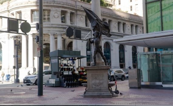
Meet at the Native Sons Monument, Montgomery at Market. Public transportation: MUNI/BART Montgomery Station; all Market Street buses & streetcars.
Please note: Private group tours required for groups of 7 or more.